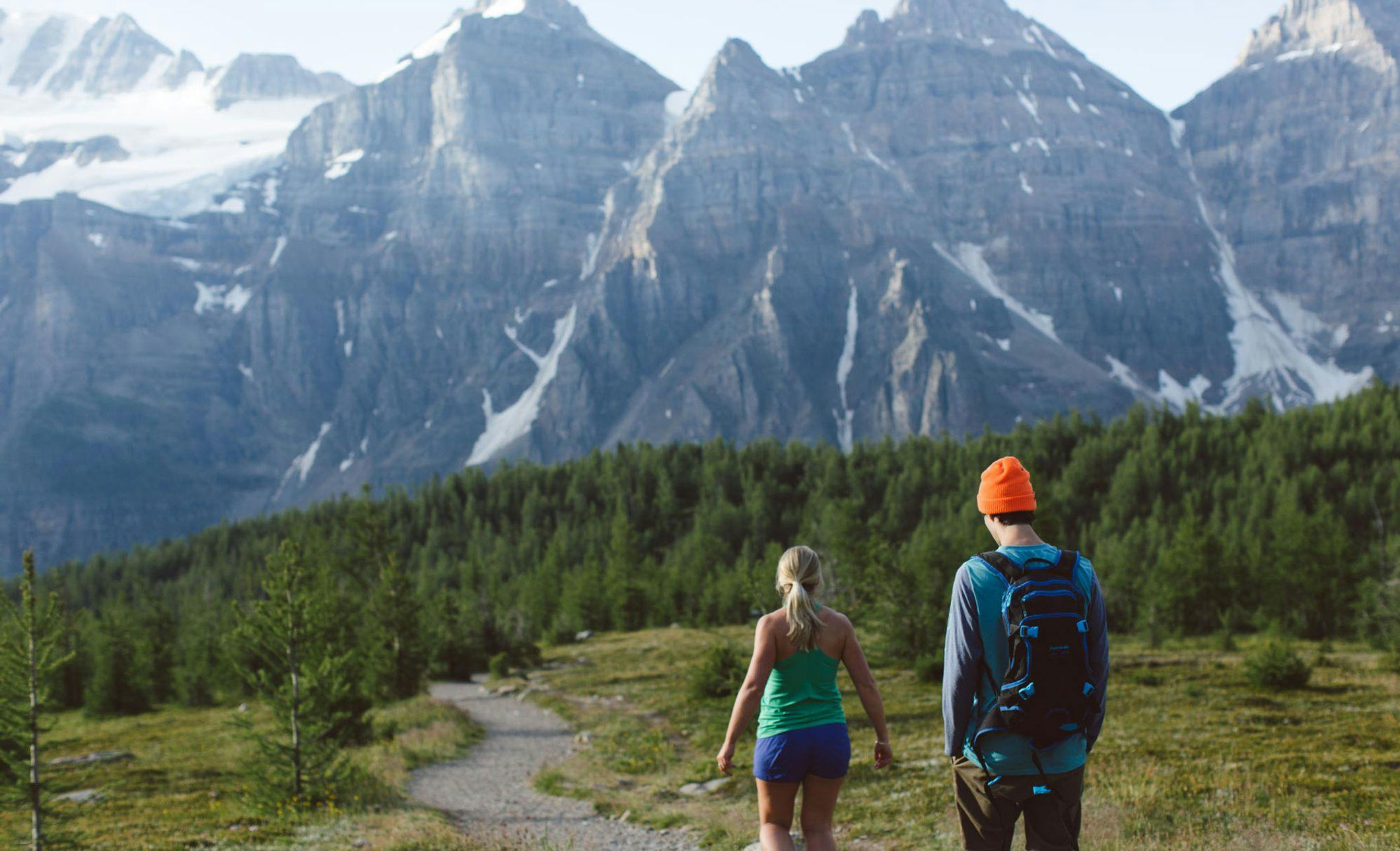
Locals' Favourite Hikes In Banff National Park
Unfold a map of Banff National Park and you can't help but notice the pattern of trails that spider out across the terrain. For many locals in Banff and Lake Louise, exploring this network of footpaths through valley bottoms, over mountain passes, and across alpine meadows quickly evolves into more than a casual hobby. With more than 1600 km of trails in all, adventurous hikers have their work cut out for them.
Our collection of locals' favourite trails includes a wide variety of adventures. Whether you're after a relaxing stroll through Sunshine Meadows or looking to explore the alpine wonderlands of Parker Ridge or Helen Lake, Banff National Park holds a lifetime of hiking adventures for all abilities.
Helen Lake
Along the trail to Helen Lake, wildflower meadows, lofty lakes and castellate peaks provide a constant change of scene that draws you onward to a remarkable, wide-open alpine landscape. | Moderate difficulty, 4 hours return.
Elevation gain: 455 metres
Allow: 4 hours return
Difficulty: Moderate
Map: Gem Trek Bow Lake & Saskatchewan Crossing
Trail Description
Starting from along the Icefields Parkway opposite the Crowfoot Glacier Viewpoint, the Helen Lake trail climbs steadily through forest along the west-facing slopes of the Bow Valley for the first three kilometres and then emerges onto steep mountainside meadows. Views open across the valley to Crowfoot Mountain and Glacier, and the sharp summit of Mount Hector (3,394 metres), down-valley to the southeast.
The trail reaches the south end of a long ridge at kilometre 3.4, where a scattering of whitebark pine indicate that you are nearing treeline. Here it switches around 180 degrees and contours into the amphitheatre containing Helen Lake.
After another kilometre of gradual ascent through lightly forested meadows, you drop beneath the toe of a relatively recent rockslide. The pile of tumbled boulders is surrounded by a lush snowbed plant community filled with the colourful blooms of purple fleabane, paintbrush, ragwort and valerian. Beyond the slide the trail climbs above the last trees and remains above treeline for the rest of the hike.
Helen Lake is bordered by open alpine meadows and scree slopes beneath the summit of Cirque Peak. It is a great place to kick back and enjoy the scene, which is home to an amazing number of hoary marmots, who seem to have nothing better to do than sit in the sun and count passing hikers.
Option
Helen Lake would be an above average destination on most hikes, but you shouldn’t end your day there. Gather your strength and continue for at least another 900 metres up a steep series of switchbacks to Cirque Peak Ridge. The 2,500-metre-high ridge, extending south from Cirque Peak, is the highest point on the trail, and it provides an outstanding overview of Katherine Lake and Dolomite Pass to the east and Helen Lake and its meadows back to the southwest. However, do take care on these exposed heights.
For most day hikers the ridge is a good spot to turn for home, but if you don’t mind climbing back over this ridge at the end of the day, you can descend to Katherine Lake and Dolomite Pass. The trail drops nearly 100 metres to the north end of Katherine Lake, which stretches beneath the castellate cliffs of Dolomite Peak. An opening beyond the south end of the lake serves as a window to the southern half of Banff National Park, and on a clear day, the sharp horn of Mount Assiniboine is visible 100 kilometres away. Though the trail is not well defined beyond Katherine Lake, it is an easy climb over spongy alpine meadows to a small lake on the crest of Dolomite Pass. Dolomite Pass lies three kilometres beyond Helen Lake, so the roundtrip to the pass will create a very full 18-kilometre day.
For current trail conditions, please check the Parks Canada trail report.
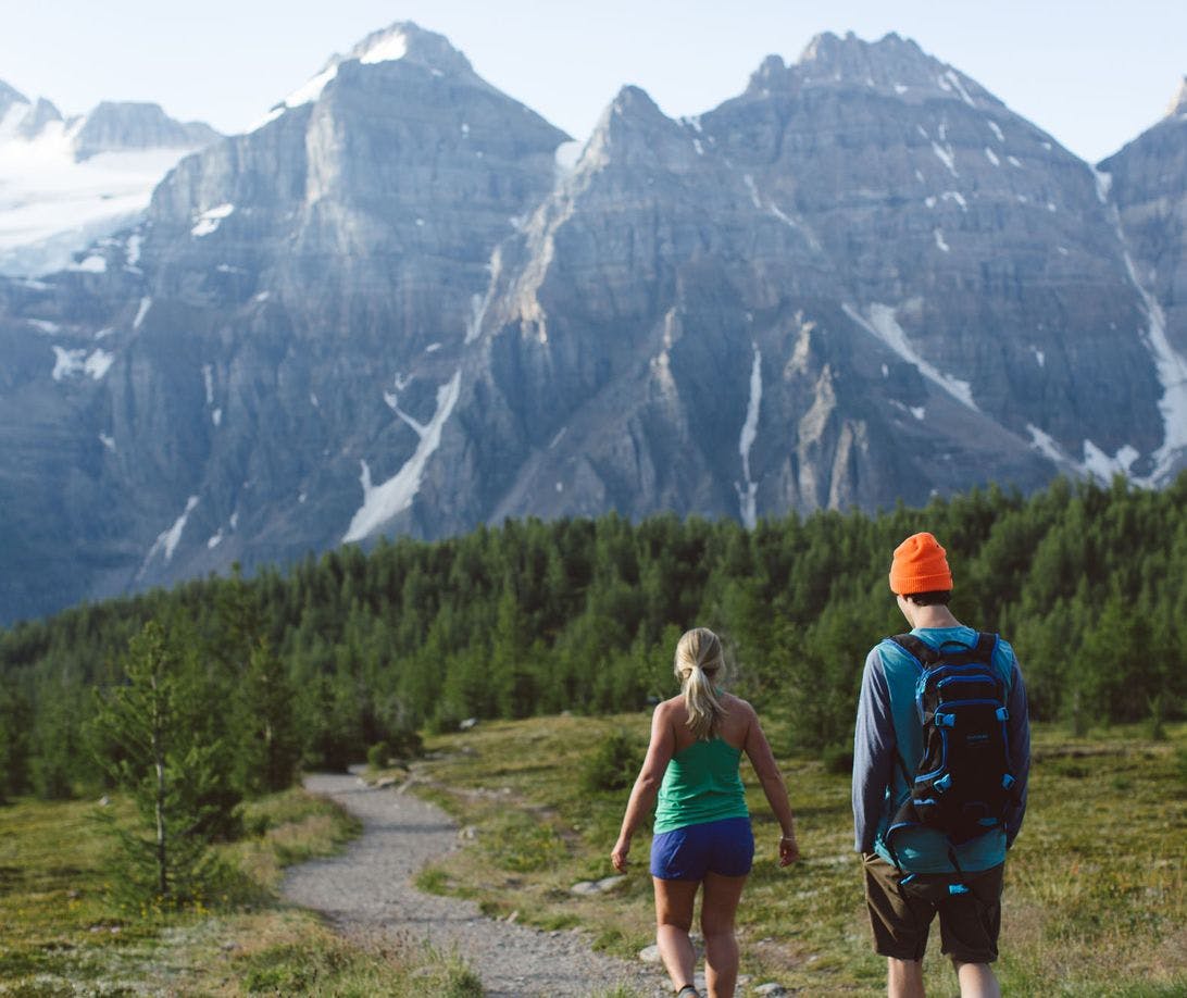
Larch Valley
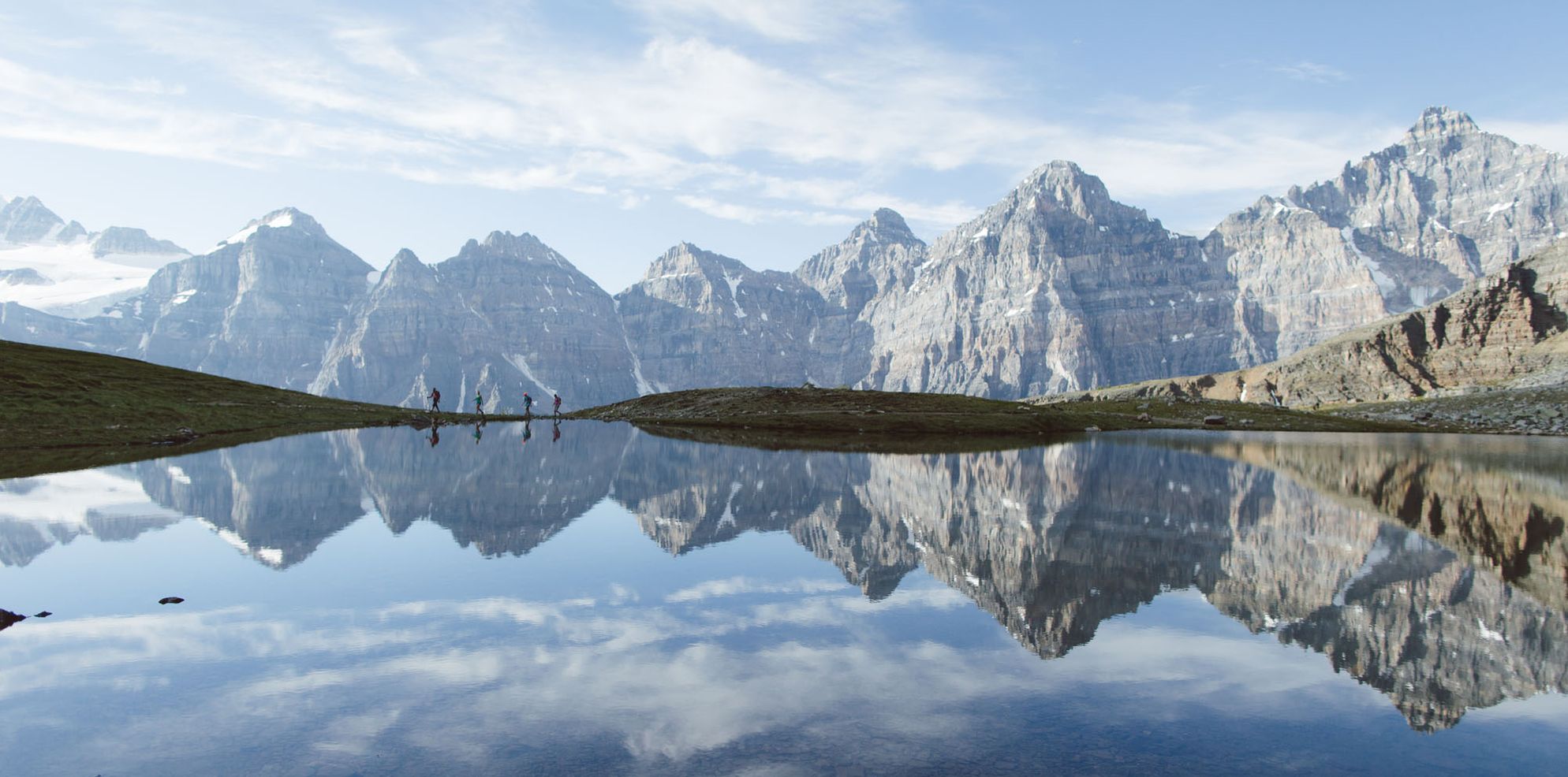
The Larch Valley meadowland above Moraine Lake, with its dense stands of alpine larch and a panoramic overview of the Ten Peaks, is exquisite. And above the valley, amid stark pinnacles of rock, is Sentinel Pass—the highest point reached by a major trail in the Canadian Rockies. | Moderate Difficulty, 3-4 hours return.
Elevation gain: 550 metres (1,800 feet)
Allow: 3-4 hours return
Rating: Moderate
Map: Gem Trek Lake Louise & Yoho
Trail Description
The Larch Valley Trail begins at Moraine Lake, a 15-kilometre drive from the village of Lake Louise along Moraine Lake Road. It is important to note that Moraine Lake Road is closed when the Moraine Lake parking area is full. This often happens as early as 7 am, so plan on arriving early or catch a shuttle. For parking and shuttle information, visit Parks Canada.
From Moraine Lake the trail to Larch Valley climbs through a forest of Engelmann spruce and alpine fir, following a steadily ascending series of switchbacks much of the way. After 2.4 kilometres of uphill hiking, the trail branches right from the Eiffel Lake trail and immediately enters the lower meadows of Larch Valley.
This high valley is the main focus for most hikers who walk the trail, and in late September, when alpine larch needles have turned to gold, it is one of the most visited trails in the Rockies. In mid-summer, however, the larch needles are a pale green and the meadows are carpeted with wildflowers.
Most hikers will want to explore the entire vale to Upper Minnestimma Lake, which lies above the last trees at the foot of Sentinel Pass. Looking south from this high meadowland, the heavily-glaciated Wenkchemna Peaks (Valley of the Ten Peaks) stretch across the horizon, providing one of the most striking panoramas in the Rockies.
Alternate Option
Ahead, between the rugged walls of Pinnacle Mountain on the left and Mount Temple on the right, is the 2,611-metre summit of Sentinel Pass. After passing the uppermost Minnestimma Lake, the trail begins a switchbacking climb of the steep, open slope leading to the pass—a vertical rise of nearly 200 metres that weeds out many Larch Valley hikers.
For current trail conditions, please check the Parks Canada trail report.
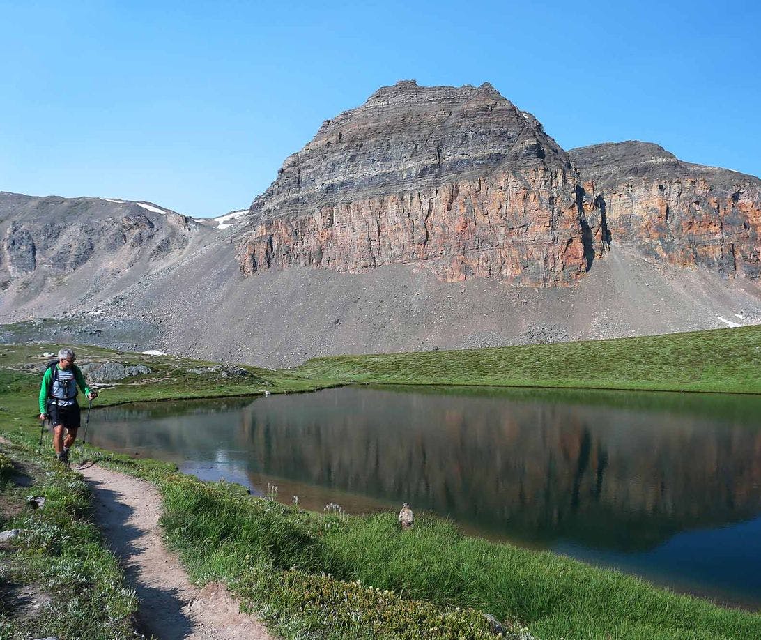
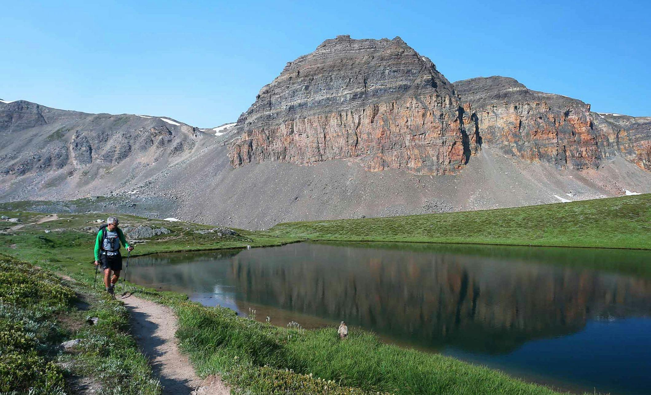
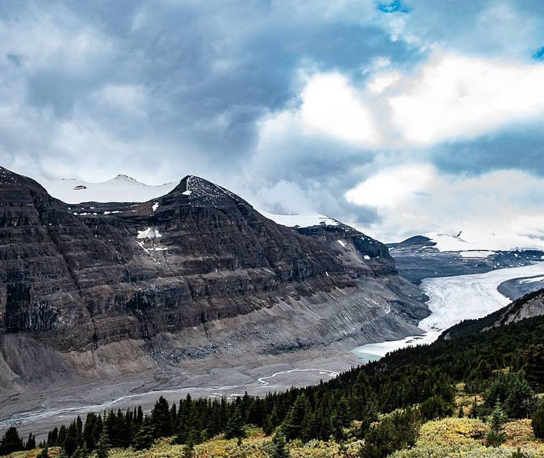
Parker Ridge
Parker Ridge is a short, wonderful excursion into the alpine life zone. The northernmost trail in Banff National Park passes through lush wildflower meadows and quickly climbs above the treeline to a high, open ridge with a spectacular view of the Saskatchewan Glacier. | Moderate difficulty, 2 hours return.

Length: 5.4 km (3.4 miles) return
Elevation gain: 250 metres (820 feet)
Allow: 2 hours return
Rating: Moderate
Map: Gem Trek Columbia Icefield
Trail Description
The Parker Ridge Trail starts from beside the Icefields Parkway just south of the Columbia Icefield and 120 kilometres north of Lake Louise. At this high elevation, some snow often lingers on the trail until July.
The lower section of the trail switchbacks steadily upward through scattered stands of alpine fir and open meadows created by snowslides. Wildflowers in this section are protected from the elements and nourished by abundant moisture from snowmelt. Tall, showy flowers, like paintbrush, valerian, purple fleabane, and fringed grass-of-Parnassus, bloom from early July through mid-August.
Halfway up the north-facing slope, at an elevation of 2,100 metres, you emerge above treeline into the alpine zone—a region of tiny ground-hugging plants. In this harsh, wind-scoured environment the blooms of moss campion, white mountain avens, rock jasmine, and forget-me-nots last only a couple of weeks.
After passing above an extensive talus slope (the domain of pikas), the trail makes its final switchbacking ascent to the 2,250-metre-high crest of the ridge. From this summit, it veers left and makes a slight descent to the first of two viewpoints for the nine-kilometre-long Saskatchewan Glacier.
While many hikers stop at the first viewpoint, another 200 metres farther along provides the most rewarding prospect of the glacier and the uppermost limits of the North Saskatchewan River Valley. A rocky promontory at the viewpoint is filled with fossil coral and covered by orange foliose (Xanthoria) lichen.
The ridgetop is also a rich area for alpine wildlife and birds. It is frequently visited by both mountain sheep and goat, and occasionally a grizzly bear wanders through. Rosy finches and horned larks nest here in summer, white-tailed ptarmigan are year-round residents, and golden eagles and hawks patrol the meadows around the glacier viewpoints for Columbian ground squirrels.
For current trail conditions, please check the Parks Canada trail report.
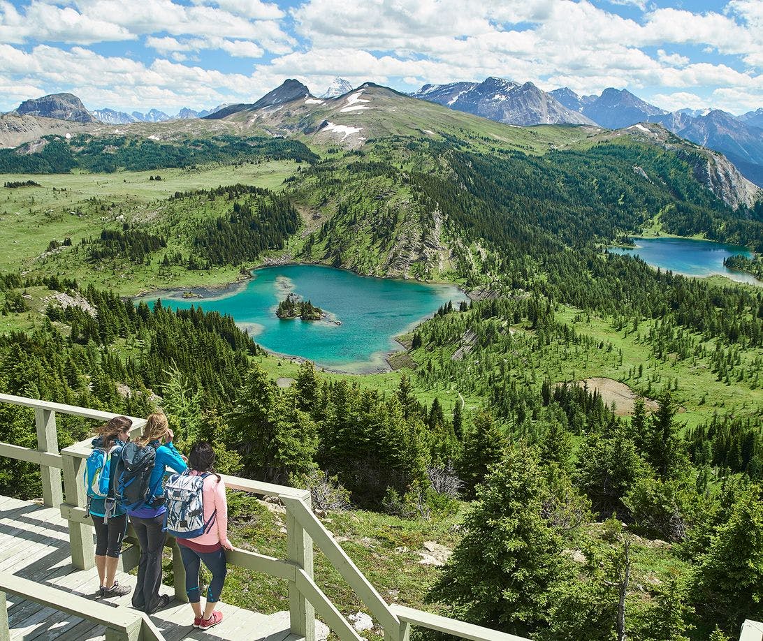
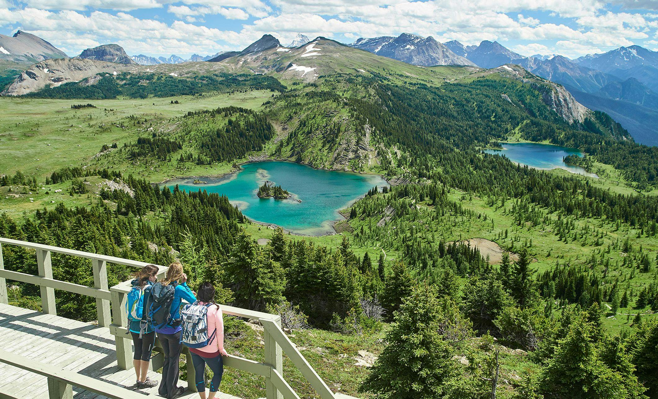
Rock Isle-Grizzly-Larix Lakes
The trail through Sunshine Meadows to Rock Isle, Grizzly and Larix Lakes is one of the most spectacular half-day hikes in Banff National Park. It includes extensive wildflower meadows and, as a bonus, a viewpoint at Rock Isle Lake that is one of the most photogenic scenes in all of the Canadian Rockies. | Easy/moderate difficulty, 3 hours return.
Elevation gain: 105 metres (350 feet)
Allow: 2.5-3 hours return
Rating: Easy/moderate
Map: Gem Trek Banff & Mount Assiniboine
Trail Description
The Rock Isle-Grizzly-Larix Lakes Trail starts from Sunshine Village, which is accessible by gondola from the Bourgeau Base area, 18 kilometres west of Banff.
From Sunshine Village, a broad gravel track climbs steadily to the Continental Divide, passing through the last scattered stands of alpine fir into a treeless alpine landscape. (Columbian ground squirrels will greet you as you climb, bounding through fields of tall, fuzzy western anemones gone-to-seed.) On the 2,305-metre summit, views stretch south across the vast Sunshine Meadows to the distant pyramid of Mount Assiniboine. The Sunshine Meadows region is unique in the Canadian Rockies. Unlike most of the Continental Divide, which is composed of glaciated peaks and towering limestone and quartzite walls, the 15-kilometre stretch of the divide between Citadel Pass and Monarch Ramparts is a mixture of subalpine and alpine meadowland. Pacific weather systems flowing in from the west add their moisture to create a vast, rolling rock garden with an incredible variety of wildflowers, some of which appear nowhere else in the range.
West of the divide, you enter British Columbia and Mount Assiniboine Provincial Park and descend to Rock Isle Lake Viewpoint. In the early morning, the waters of Rock Isle Lake are often a mirror reflecting its rocky island and shoreline. There is a peacefulness and natural symmetry in the scene, including distant peaks in British Columbia that has attracted artists and photographers for many decades.
From the Rock Isle Lake Viewpoint, the trail veers to the west and quickly reaches the junction for the Twin Cairns-Meadow Park trail. Stay left. The trail climbs over a low, rocky hill to where the lake’s outlet stream plunges down steep limestone slabs. From this wonderful natural waterslide, you see across the Simpson Valley to the distant peaks of Kootenay National Park.
Continuing beyond the lake’s outlet, the trail drops through open forest and lush meadows filled with wildflowers. Soon the trail splits to begin a 2.5-kilometre loop around Grizzly and Larix Lakes. Keep right and descend to Grizzly Lake, where scarring from a 2017 wildfire can be seen on the distant shore. From the lake’s inlet bridge, the trail turns left and contours the lip of the basin to a fine viewpoint for the Simpson Valley.
Larix, the largest of the two lakes, is just beyond the viewpoint. The lake lies between meadow and larch forest (the Latin botanical name for alpine larch is Larix lyallii, hence the lake’s name.) You follow the shoreline before climbing back to the loop split and returning to Rock Isle Lake.
Option
Rather than walking up the trail to Rock Isle Lake, many hikers ride the Standish Chairlift from Sunshine Village to the Standish Viewing Deck, which sits at an elevation of 2,420 metres atop Standish Ridge.
From the top of the Standish Chairlift, the trail follows the ridge for 300 metres to the Standish Viewing Deck, then descends steeply for 300 metres to the Twin Cairns-Meadow Park trail. Take the left fork and it’s 400 metres to the Rock Isle-Grizzly-Larix Lakes loop junction. By starting with a ride on the Standish Chairlift and returning to Sunshine Village via the Rock Isle Lake viewpoint, the Rock Isle-Grizzly-Larix Lakes loop is 7.2 kilometres (2 to 2.5 hours roundtrip).
Energetic hikers can make a full day of it by completing the Rock Isle-Grizzly-Larix Lakes loop then hiking back to Sunshine Village via Twin Cairns-Meadow Park. This option totals around 10 kilometres.
For current trail conditions, please check the Parks Canada trail report.
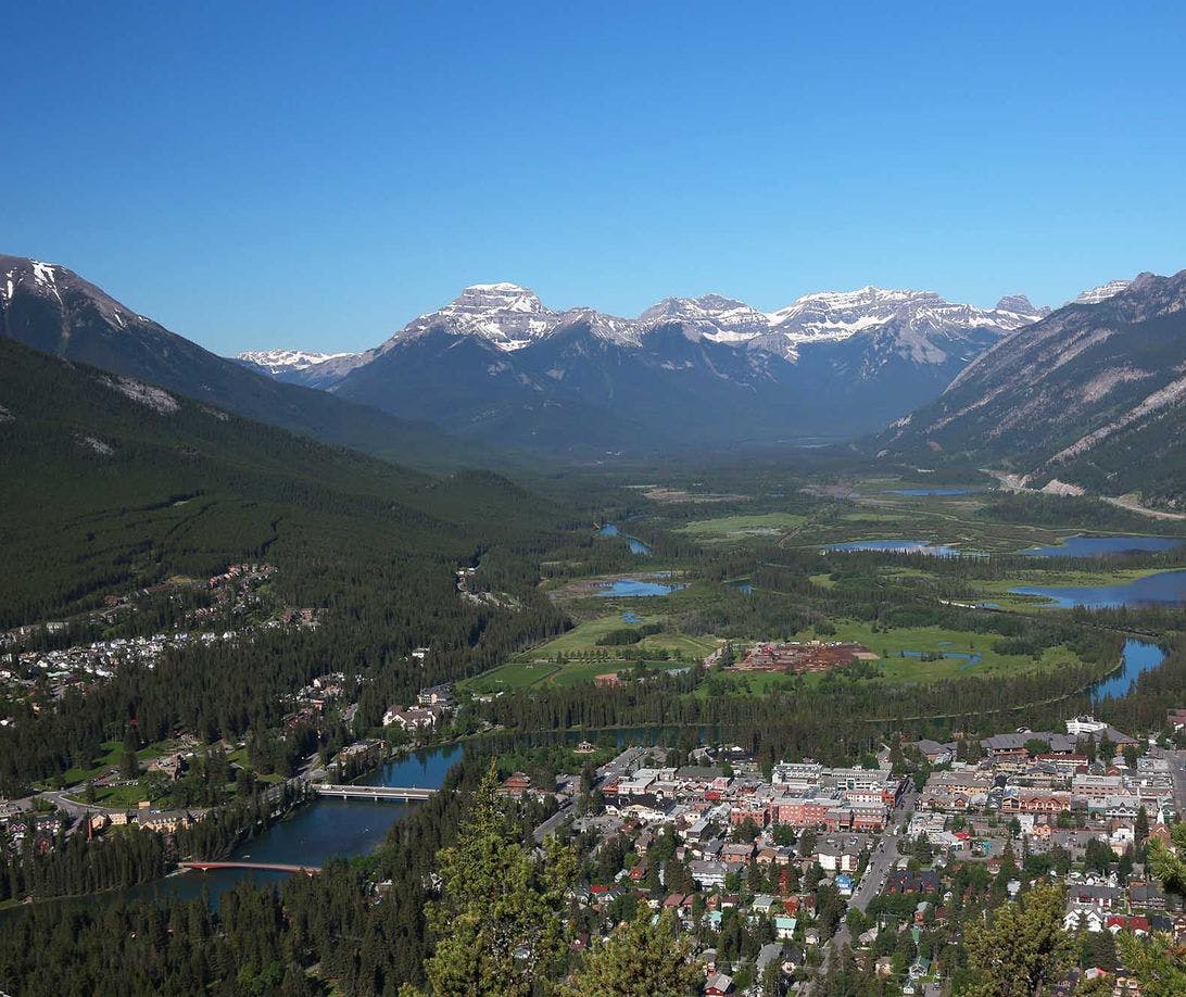
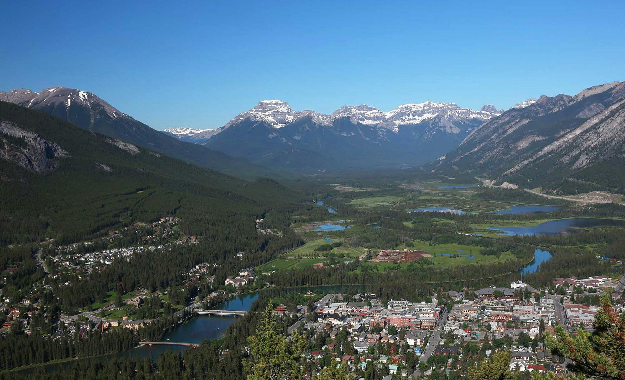
Tunnel Mountain
The Tunnel Mountain hike is short and readily accessible from downtown Banff. The summit offers excellent views of the Banff environs, the north ridge of Mount Rundle, and a 30-kilometre stretch of the Bow Valley. | Easy/Moderate Difficulty, 2 hours return.
Elevation gain: 260 metres (845 feet)
Allow: 2 hours return
Rating: Easy/moderate
Map: Gem Trek Banff Up Close
Trail Description
The Tunnel Mountain trailhead is reachable on foot from downtown Banff. From Banff Avenue, follow Wolf Street to St. Julien Road; stay right the trail starts 300 metres along St. Julien.
A series of sweeping switchbacks make a gradual but steady ascent through a thick forest of lodgepole pine and Douglas fir. Once you cross the Tunnel Mountain Drive (an optional starting point if you want to shorten your hike), there are occasional glimpses of the town and valley. These openings culminate at a good viewpoint beside a series of limestone slabs near the summit ridge—a panorama that includes the town and Banff Springs Hotel. A few rare limber pines grow beside the trail.
On the summit ridge, the trail doubles back and climbs gradually above the mountain’s sheer, east-facing cliffs. Views along the ridge extend over the Banff Springs Golf Course and down-valley to the park’s eastern boundary near Canmore.
The trail ends on the sparsely-forested summit, which was once the site of a fire lookout tower. Limestone outcrops just west of the summit provide the best views up the Bow Valley to the west and include Banff, the Vermilion Lakes and Massive Range. (Look for crinoid, coral and brachiopod fossils in the limestone slabs.)
For current trail conditions, please check the Parks Canada trail report.